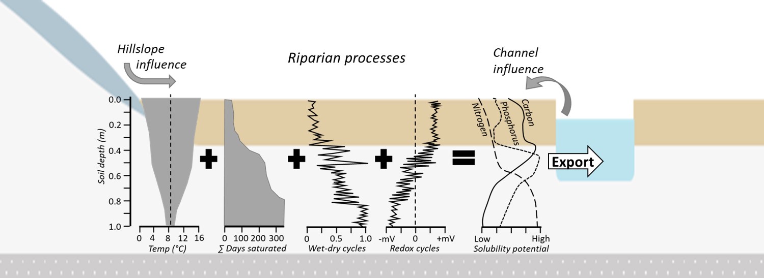
Overview of monitoring approach in riparian zones
The field site monitoring approach will cover a wide range of physical and chemical processes within the soil-water interface.
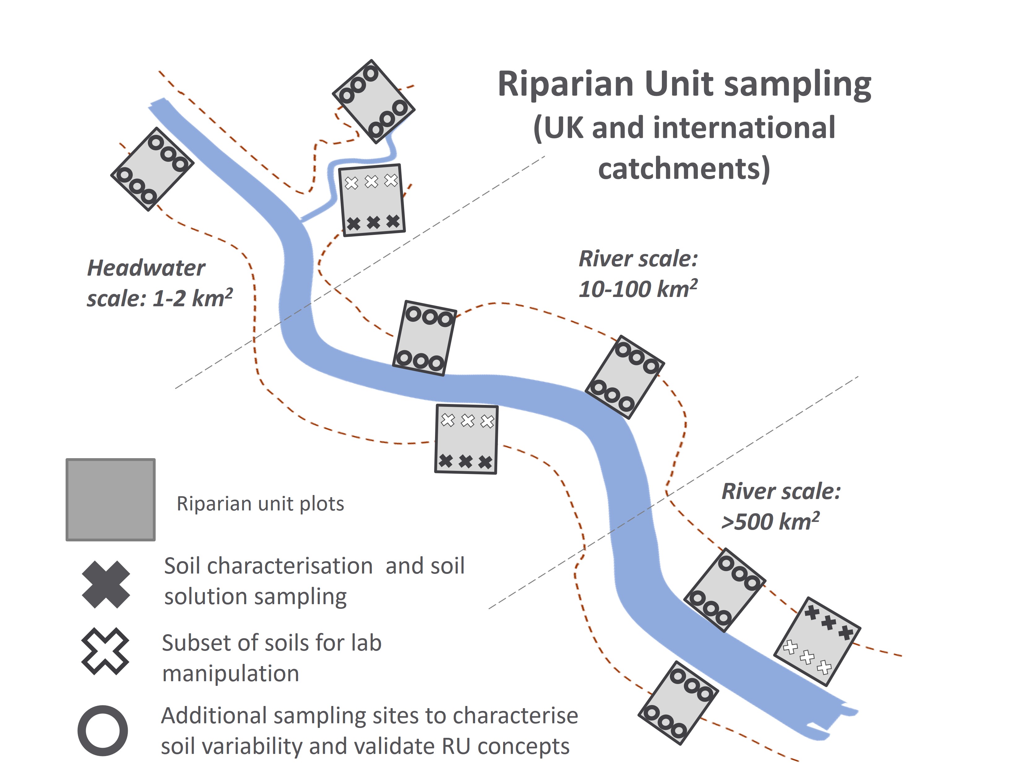
Each river scale has one temporal monitoring site and a further two one-off characterisation sites.
Temporal monitoring is by:
- Water table and temperature – Pressure transducers record water height (60 mins) above the base of the shallow borehole (set to chart datum a.s.l.), air and soil water temperature.
- Soil moisture - 1 m depth profile locations of soil moisture (monthly) using Delta-T survey probes via permanent access tubes, relating to initiation of soil water flows via soil hydraulic calibrations.
- River water height - Pressure transducer stage height (15 mins) for relating hydraulic gradients (hillslope-riparian-channel) and river flow through a rating relationship.
- Monthly soil solution – Suction cup lysimeters operated by vacuum pump are installed at three different depths at each of the groundwater sensors.
- Monthly river water samples – For nutrient analyses to compare with soils, characterise stream conditions and generate hydrochemical fluxes.
- Redox/pH – Installation of redox electrodes used to determine pH/Eh, as well as in-situ use of direct indicators of redox effects in soil profiles using IRIS oxides Fe and Mn coated paper films.